Google Earth in Artsakh
I’ve discovered Google Earth and wow, what an adventure it is to fly from one end of Earth to the other.
I found it interesting that there are some areas in Artsakh that have high-resilution (not as high as they have of Los Angeles, but still high enough to make out what is on the ground).
The area of Stepanagert (which on the map is referred to as Xankandi) is a much lower resolution than Shushi (referred to as Shusha).
 Mardakert and Aghdam are both in a low resolution where you really can’t make out anything, but low a behold, Martuni had been photographed at the same resolution as Shushi.
I wonder what is so special about Martuni and who ordered it to be photographed so well? Our military bases in our region sure are detailed.
I’m kind of glad that we have the high-res pictures as it was fun to see what my neighbors have in their back yard and to better understand where things are and all the little hidden roads I didn’t even know about or those I do, where they lead to.
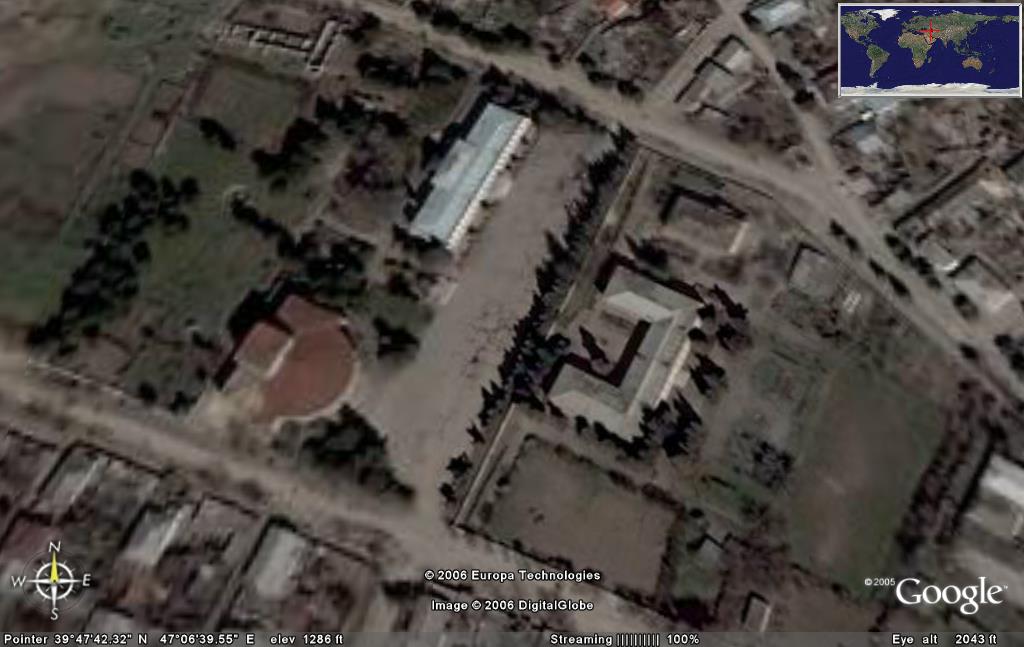
The picture I’ve posted is of our government square where between the three big buildings is Monte Melkonian’s statue.
I’m guessing these picture were recent or taken last year around this time, as in some of the areas on Artsakh territory you can see fires burning in the recently harvested fields.
Thanks Google Earth, you’re the best!!!
I found it interesting that there are some areas in Artsakh that have high-resilution (not as high as they have of Los Angeles, but still high enough to make out what is on the ground).
The area of Stepanagert (which on the map is referred to as Xankandi) is a much lower resolution than Shushi (referred to as Shusha).
 Mardakert and Aghdam are both in a low resolution where you really can’t make out anything, but low a behold, Martuni had been photographed at the same resolution as Shushi.
 I wonder what is so special about Martuni and who ordered it to be photographed so well? Our military bases in our region sure are detailed.
I’m kind of glad that we have the high-res pictures as it was fun to see what my neighbors have in their back yard and to better understand where things are and all the little hidden roads I didn’t even know about or those I do, where they lead to.
The picture I’ve posted is of our government square where between the three big buildings is Monte Melkonian’s statue.
I’m guessing these picture were recent or taken last year around this time, as in some of the areas on Artsakh territory you can see fires burning in the recently harvested fields.
Thanks Google Earth, you’re the best!!!
No comments:
Post a Comment